
Ask the map a question — or let an agent ask it.
A chat interface sitting on an ArcGIS map that speaks ESRI GeoServices, OGC API Features and OGC WFS interchangeably, filters across all three with one query language, and generates SQL against your own spatial database. Every capability is also exposed as an MCP tool, so Claude Desktop and your own agents can drive the whole thing.
GIS answers are locked behind GIS skills
The data is published, the services are open, the analysis is routine. Getting an answer out still requires knowing which button to press.
The tool needs training
Everyone in the organisation has spatial questions. A small number of them know how to build a definition query, and they become the queue everyone waits in.
Standards do not interoperate
ESRI, OGC API Features and WFS answer the same questions in different dialects. A filter written for one is worth nothing against the others.
Analysis means moving data
The usual answer to "query my database spatially" is an ETL pipeline and a second copy of the data that is immediately out of date.
Agents cannot reach it
An AI assistant that can read your email but not your parcel service is not much use for the questions that actually involve land.
Chat on the left, ArcGIS on the right
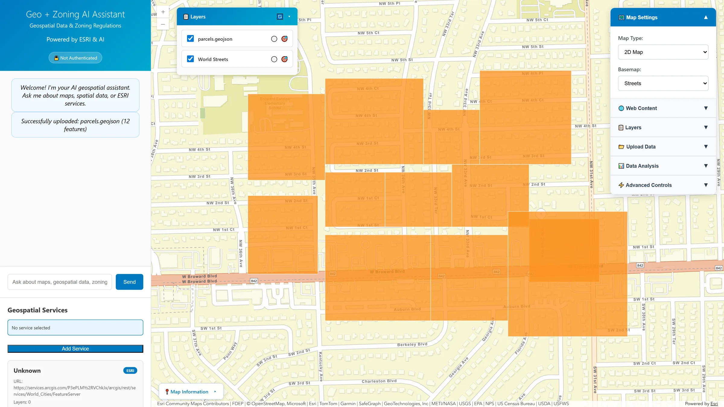
The assistant sits beside a live ArcGIS Maps SDK view. Add a service by URL and it detects the type for you; drop in a GeoJSON or KML and it lands on the map as a layer; then ask about what is there in plain language.
- Point it at any service URL — the type is identified automatically, and its layers or collections are listed without you knowing which standard you just pasted.
- 2D and 3D — switch between map and scene views, with WebMap and WebScene loading by ID and multiple basemaps.
- No-code configuration — a whole map can be described with a WebMap ID, a WebScene ID or CatalogLayer JSON instead of code.
- Streaming answers with persistent sessions, so a line of questioning keeps its context.
Three dialects, one query language
The awkward part of standards-compliant GIS is that there are several standards. The service layer abstracts them behind one interface and converts filters between them.
| Standard | What it covers | Output formats |
|---|---|---|
| ESRI GeoServices | FeatureServer, MapServer and ImageServer endpoints, plus WebMap and WebScene loading by ID | JSON, GeoJSON, ESRIJSON, PBF, KML |
| OGC API Features | Modern RESTful collections with CQL-2 filtering | JSON, GeoJSON |
| OGC WFS | Traditional Web Feature Service with spatial operations | GML, GeoJSON |
- Automatic service detection — paste a URL and the type is worked out from it, rather than asking the user to classify their own endpoint.
- CQL in text and JSON form —
LIKE,IN,BETWEENand comparison operators for attributes;INTERSECTS,WITHIN,CONTAINSandDWITHINfor geometry. - Cross-service filter conversion — one filter is translated into whatever dialect the answering service expects, so a query written once works everywhere.
- Bounding-box queries for cheap spatial extent filtering before anything heavier runs.
# Auto-detect what kind of service this even is
curl '…/api/geo/services/detect-type?url=<service>'

# List layers or collections — same call either way
curl '…/api/geo/services/layers?url=<service>'

# Query with CQL; the proxy converts to the right dialect
curl -X POST '…/api/geo/query/features' \
  -H 'Content-Type: application/json' \
  -d '{
    "url": "<service>",
    "cql": "zoning LIKE '\''C-%'\'' AND
            INTERSECTS(geom, BBOX(-80.3,25.7,-80.1,25.9))"
  }'

# Or translate a filter between languages explicitly
curl -X POST '…/api/geo/filters/convert'
Upload, analyse, query
Captured from a running instance.
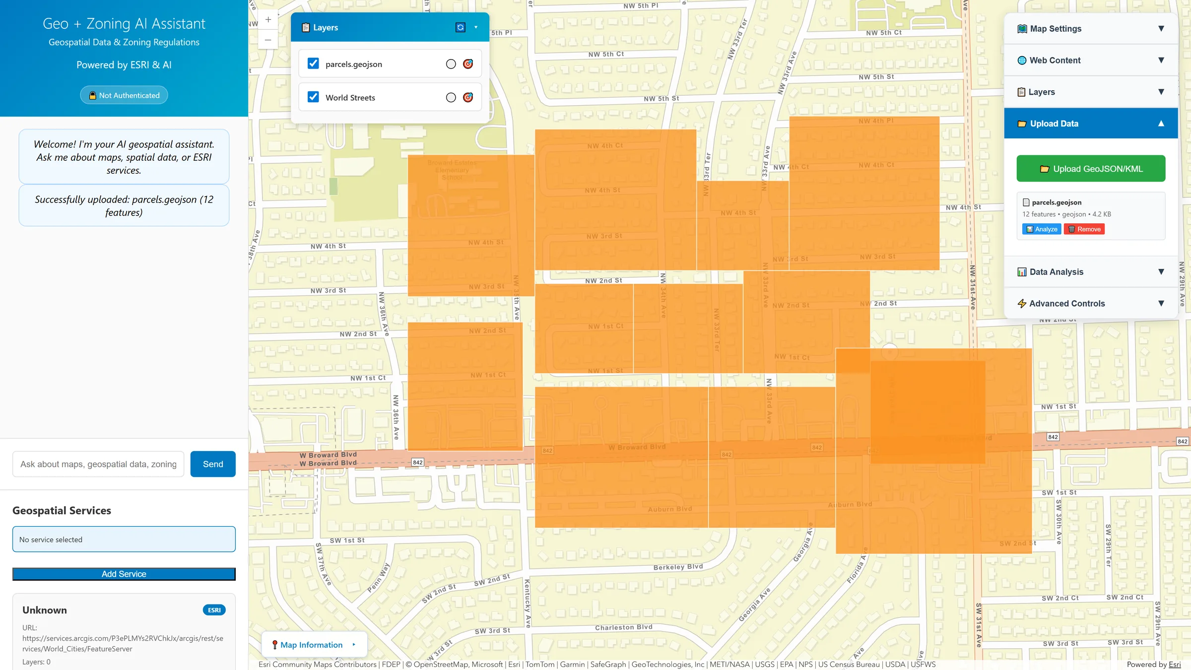
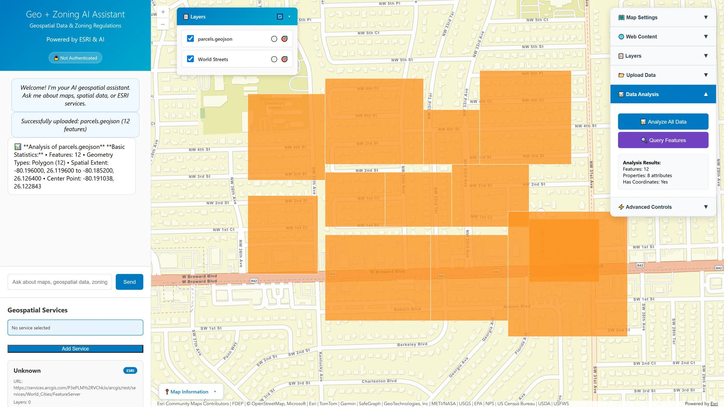
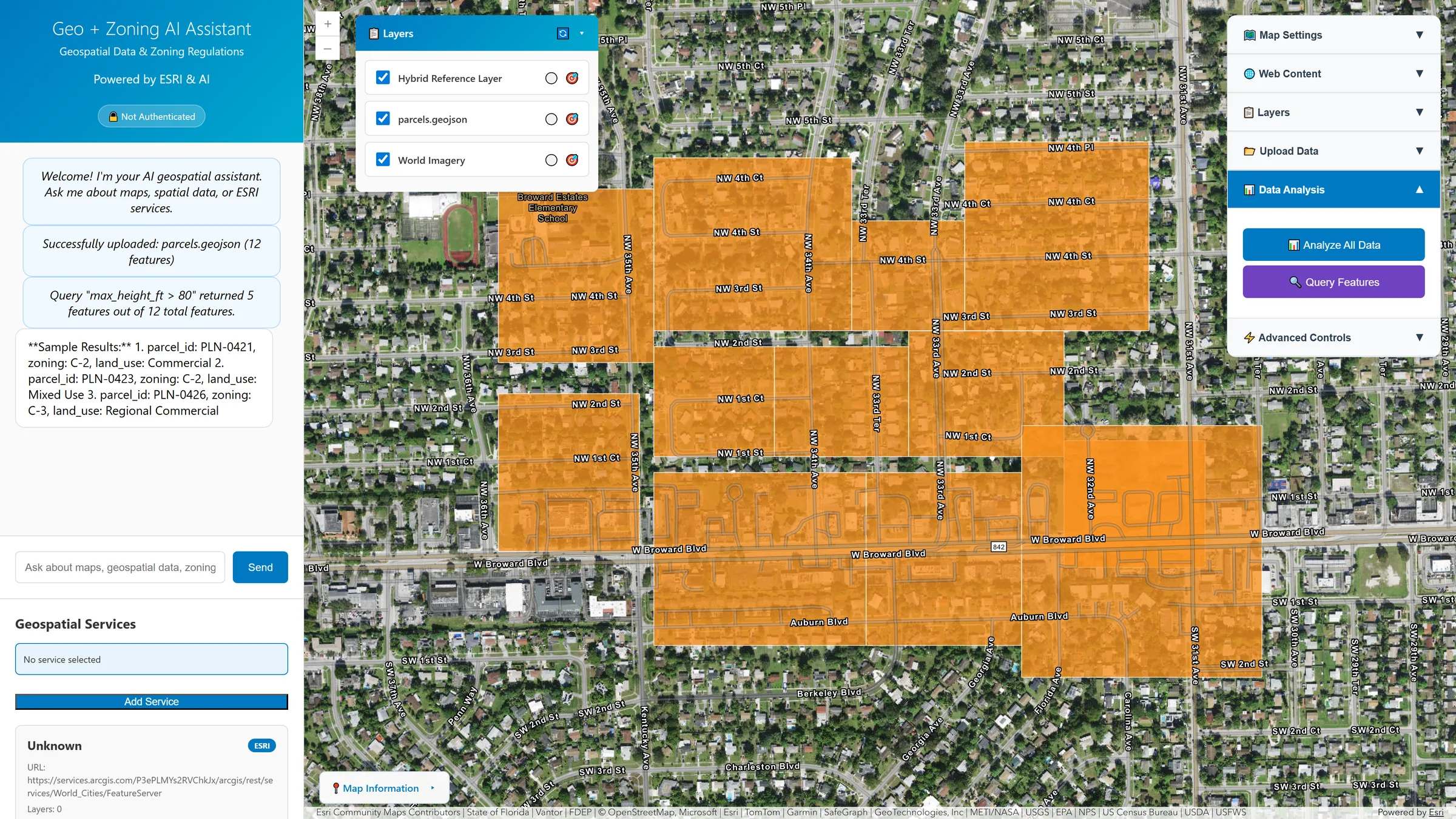
* Screens show a development instance with a small sample parcel file; parcel identifiers and attribute values in them are illustrative.
The part an AI agent can actually use
Every API this platform exposes is also published as an MCP tool. That means an agent — Claude Desktop, an internal assistant, a scheduled automation — can query your geospatial services directly, rather than being told about them second-hand.
- 20+ tools covering chat, ESRI service queries, database questions and map configuration — the full backend surface, not a curated subset.
- Standardised protocol, so anything that speaks MCP works without a bespoke integration on either side.
- Async execution and batch operations, so an agent working through a list of parcels is not making one blocking call at a time.
- Session management — context persists across an agent's turns the same way it does for a person in the chat panel.
Query your own spatial database, without copying it
Natural language becomes SQL that runs against the database you already have — no ETL, no second copy, no synchronisation problem.
PostGIS-native
Spatial SQL is generated directly — ST_DWithin, ST_Intersects, ST_Area — rather than pulling rows out and post-processing them. PostgreSQL, MySQL, SQLite, DuckDB, Snowflake and BigQuery are all supported connections.
Read-only, enforced
Generated SQL is gated before execution: only read operations are permitted, and known injection shapes — statement chaining, comment truncation, union-based attacks — are blocked by pattern matching rather than trusted to the model.
It learns your schema
The model is trained on your DDL, documentation and worked query examples, so accuracy improves with use. Repeated questions are cached, and generated SQL can be reviewed before it runs.
Including on infrastructure with no internet
The AI provider is configuration, not architecture. That matters for organisations whose parcel and permit data is not allowed to leave the building.
- Cloud providers — OpenAI, Anthropic, or OpenRouter for access to a wide model catalogue behind one key.
- Fully local inference — Ollama, vLLM or LlamaCpp, or any OpenAI-compatible endpoint you host yourself. Nothing leaves your network.
- Swap without code changes — the provider is an environment variable; adding a new one is a class and a registry entry.
- Packaged for real estates of infrastructure — Docker Compose, Kubernetes, Debian and RHEL packages, Windows/IIS and systemd.
The conversational front door
Other solutions produce the data. This is the one you talk to — and the one your agents can reach.
Beside ordinance Q&A
Zoning Code Intelligence answers from legal text with citations. This answers from live feature services and your database. Different corpora, complementary questions.
Solution detail →The ArcGIS-side counterpart
Land Intelligence is the MapLibre analyst workspace. This is the ArcGIS-native conversational one — the right pick when the organisation is already standardised on Esri.
Solution detail →Pointed at federated parcels
The federation proxy publishes FeatureServer and OGC API Features contracts — both of which this assistant already speaks, so nationwide parcels become one more service URL to add.
Solution detail →Point it at a service you already run
The quickest way to judge this is to give it one of your own endpoints and ask it something awkward. Tell us whether you need cloud models or fully local inference and we will demo the configuration you would actually deploy — including the MCP server against your own agent.